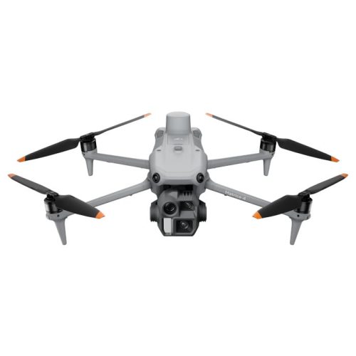
Aircraft
Weight (with propellers, without accessories) [1]
DJI Mavic 3E: 915 g
DJI Mavic 3T: 920 g
Max Takeoff Weight
DJI Mavic 3E: 1,050 g
DJI Mavic 3T: 1,050 g
Dimensions
Folded (without propellers): 221×96.3×90.3 mm (L×W×H)
Unfolded (without propellers): 347.5×283×107.7 mm (L×W×H)
Diagonal Distance
380.1 mm
Max Ascent Speed
6 m/s (Normal Mode)
8 m/s (Sport Mode)
Max Descent Speed
6 m/s (Normal Mode)
6 m/s (Sport Mode)
Max Flight Speed (at sea level, no wind)
15 m/s (Normal Mode)
Forward: 21 m/s, Side: 20 m/s, Backward: 19 m/s (Sport Mode) [2]
Max Wind Speed Resistance
12 m/s [3]
Max Take-off Altitude Above Sea Level
6000 m (without payload)
Max Flight Time (no wind)
45 mins [4]
Max Hover Time (no wind)
38 mins
Max Flight Distance
32 km
Max Pitch Angle
30° (Normal Mode)
35° (Sport Mode)
Max Angular Velocity
200°/s
GNSS
GPS+Galileo+BeiDou+GLONASS (GLONASS is supported only when the RTK module is enabled)
Hovering Accuracy
Vertical: ±0.1 m (with Vision System); ±0.5 m (with GNSS); ±0.1 m (with RTK)
Horizontal: ±0.3 m (with Vision System); ±0.5 m (with High-Precision Positioning System); ±0.1 m (with RTK)
Operating Temperature Range
-10° to 40° C (14° to 104° F)
Internal Storage
N/A
Motor Model
2008
Propeller Model
9453F Propellers for Enterprise
Beacon
Built into the aircraft
Wide Camera
Sensor
DJI Mavic 3E: 4/3 CMOS, Effective pixels: 20 MP
DJI Mavic 3T: 1/2-inch CMOS, Effective pixels: 48 MP
Lens
DJI Mavic 3E:
FOV: 84°
Format Equivalent: 24 mm
Aperture: f/2.8-f/11
Focus: 1 m to ∞
DJI Mavic 3T:
FOV: 84°
Format Equivalent: 24 mm
Aperture: f/2.8
Focus: 1 m to ∞
ISO Range
DJI Mavic 3E: 100-6400
DJI Mavic 3T: 100-25600
Shutter Speed
DJI Mavic 3E:
Electronic Shutter: 8-1/8000 s
Mechanical Shutter: 8-1/2000 s
DJI Mavic 3T:
Electronic Shutter: 8-1/8000 s
Max Image Size
DJI Mavic 3E: 5280×3956
DJI Mavic 3T: 8000×6000
Still Photography Modes
DJI Mavic 3E:
Single: 20 MP
Timed: 20 MP
JPEG: 0.7/1/2/3/5/7/10/15/20/30/60 s
JPEG+RAW: 3/5/7/10/15/20/30/60 s
Smart Low-light Shooting: 20 MP
Panorama: 20 MP (raw image)
DJI Mavic 3T:
Single: 12 MP/48 MP
Timed: 12 MP/48 MP
JPEG: 2/3/5/7/10/15/20/30/60 s*
Panorama: 12 MP (raw image); 100 MP (stitched image)
* Shooting 48MP photo does not support 2s interval
Smart Low-light Shooting: 12 MP
Video Resolution
H.264
4K: 3840×2160@30fps
FHD: 1920×1080@30fps
Bitrate
DJI Mavic 3E:
4K: 130 Mbps
FHD: 70 Mbps
DJI Mavic 3T:
4K: 85 Mbps
FHD: 30 Mbps
Supported File Formats
exFAT
Photo Format
DJI Mavic 3E: JPEG/DNG (RAW)
DJI Mavic 3T: JPEG
Video Format
MP4 (MPEG-4 AVC/H.264)
Tele Camera
Sensor
1/2-inch CMOS, Effective pixels: 12 MP
Lens
FOV: 15°
Format Equivalent: 162 mm
Aperture: f/4.4
Focus: 3 m to ∞
ISO Range
DJI Mavic 3E: 100-6400
DJI Mavic 3T: 100-25600
Shutter Speed
Electronic Shutter: 8-1/8000 s
Max Image Size
4000×3000
Photo Format
JPEG
Video Format
MP4 (MPEG-4 AVC/H.264)
Still Photography Modes
DJI Mavic 3E:
Single: 12 MP
Timed: 12 MP
JPEG: 0.7/1/2/3/5/7/10/15/20/30/60 s
Smart Low-light Shooting: 12 MP
DJI Mavic 3T:
Single: 12 MP
Timed: 12 MP
JPEG: 2/3/5/7/10/15/20/30/60 s
Smart Low-light Shooting: 12 MP
Video Resolution
H.264
4K: 3840×2160@30fps
FHD: 1920×1080@30fps
Bitrate
DJI Mavic 3E:
4K: 130 Mbps
FHD: 70 Mbps
DJI Mavic 3T:
4K: 85 Mbps
FHD: 30 Mbps
Digital Zoom
8x (56x hybrid zoom)
Thermal Camera [5]
Thermal Imager
Uncooled VOx Microbolometer
Pixel Pitch
12 μm
Frame Rate
30 Hz
Lens
DFOV: 61°
Format Equivalent: 40 mm
Aperture: f/1.0
Focus: 5 m to ∞
Noise Equivalent Temperature Difference (NETD)
≤50 mK@F1.0
Temperature Measurement Method
Spot Meter, Area Measurement
Temperature Measurement Range
-20° to 150° C (-4° to 302° F, High Gain Mode)
0° to 500° C (32° to 932° F, Low Gain Mode)
Palette
White Hot/Black Hot/Tint/Iron Red/Hot Iron/Arctic/Medical/Fulgurite/Rainbow 1/Rainbow 2
Photo Format
JPEG (8-bit)
R-JPEG (16-bit)
Video Resolution
640×512@30fps
Bitrate
6 Mbps
Video Format
MP4 (MPEG-4 AVC/H.264)
Still Photography Modes
DJI Mavic 3T:
Single: 640×512
Timed: 640×512
JPEG: 2/3/5/7/10/15/20/30/60 s
Digital Zoom
28x
Infrared Wavelength
8-14 μm
Infrared Temperature Measurement Accuracy
±2° C or ±2% (using the larger value)
Gimbal
Stabilization
3-axis (tilt, roll, pan)
Mechanical Range
DJI Mavic 3E:
Tilt: -135° to 100°
Roll: -45° to 45°
Pan: -27° to 27°
DJI Mavic 3T:
Tilt: -135° to 45°
Roll: -45° to 45°
Pan: -27° to 27°
Controllable Range
Tilt: -90° to 35°
Pan: Not controllable
Max Control Speed (tilt)
100°/s
Angular Vibration Range
±0.007°
Sensing
Type
Omnidirectional binocular vision system, supplemented with an infrared sensor at the bottom of the aircraft.
Forward
Measurement Range: 0.5-20 m
Detection Range: 0.5-200 m
Effective Sensing Speed: Flight Speed ≤15 m/s
FOV: Horizontal 90°, Vertical 103°
Backward
Measurement Range: 0.5-16 m
Effective Sensing Speed: Flight Speed ≤12 m/s
FOV: Horizontal 90°, Vertical 103°
Lateral
Measurement Range: 0.5-25 m
Effective Sensing Speed: Flight Speed ≤15 m/s
FOV: Horizontal 90°, Vertical 85°
Upward
Measurement Range: 0.2-10 m
Effective Sensing Speed: Flight Speed ≤6 m/s
FOV: Front and Back 100°, Left and Right 90°
Downward
Measurement Range: 0.3-18 m
Effective Sensing Speed: Flight Speed ≤6 m/s
FOV: Front and Back 130°, Left and Right 160°
Operating Environment
Forward, Backward, Lateral, and Upward: Surface with a clear pattern and adequate lighting (lux >15)
Downward: Diffuse reflective surface with diffuse reflectivity>20% (e.g. walls, trees, people) and adequate lighting (lux >15)
Video Transmission
Video Transmission System
DJI O3 Enterprise Transmission
Live View Quality
Remote Controller: 1080p/30fps
Operating Frequency [6]
2.400-2.4835 GHz
5.725-5.850 GHz
Max Transmission Distance (unobstructed, free of interference) [7]
DJI Mavic 3E:
FCC: 15 km
CE: 8 km
SRRC: 8 km
MIC: 8 km
DJI Mavic 3T:
FCC: 15 km
CE: 8 km
SRRC: 8 km
MIC: 8 km
Max Transmission Distance (Obstructed) [8]
Strong Interference (dense buildings, residential areas, etc.): 1.5-3 km (FCC/CE/SRRC/MIC)
Medium Interference (suburban areas, city parks, etc.): 3-9 km (FCC), 3-6 km (CE/SRRC/MIC)
Low Interference (open spaces, remote areas, etc.): 9-15 km (FCC), 6-8 km (CE/SRRC/MIC)
Max Download Speed[9]
15 MB/s (with DJI RC Pro Enterprise)
Latency (depending on environmental conditions and mobile device)
Approx. 200 ms
Antenna
4 Antennas, 2T4R
Transmission Power (EIRP)
2.4 GHz: <33 dBm (FCC), <20 dBm (CE/SRRC/MIC)
5.8 GHz: <33 dBm (FCC), <30 dBm (SRRC), <14 dBm (CE)
DJI RC Pro Enterprise
Video Transmission System
DJI O3 Enterprise Transmission
Max Transmission Distance (unobstructed, free of interference) [7]
FCC: 15 km
CE/SRRC/MIC: 8 km
Video Transmission Operating Frequency [6]
2.400-2.4835 GHz
5.725-5.850 GHz
Antenna
4 Antennas, 2T4R
Video Transmission Transmitter Power (EIRP)
2.4 GHz: <33 dBm (FCC), <20 dBm (CE/SRRC/MIC)
5.8 GHz: <33 dBm (FCC), <14 dBm (CE), <23 dBm (SRRC)
Wi-Fi Protocol
802.11 a/b/g/n/ac/ax
Support 2×2 MIMO Wi-Fi
Wi-Fi Operating Frequency [6]
2.400-2.4835 GHz
5.150-5.250 GHz
5.725-5.850 GHz
Wi-Fi Transmitter Power (EIRP)
2.4 GHz: <26 dBm (FCC), <20 dBm (CE/SRRC/MIC)
5.1 GHz: <26 dBm (FCC), <23 dBm (CE/SRRC/MIC)
5.8 GHz: <26 dBm (FCC/SRRC), <14 dBm (CE)
Bluetooth Protocol
Bluetooth 5.1
Bluetooth Operating Frequency
2.400-2.4835 GHz
Bluetooth Transmitter Power (EIRP)
< 10 dBm
Screen Resolution
1920×1080
Screen Size
5.5 inches
Screen
60 fps
Brightness
1,000 nits
Touchscreen Control
10-point multi-touch
Battery
Li-ion (5000 mAh @ 7.2 V)
Charging Type
Recommended to be charged with the included DJI USB-C Power Adapter (100W) or USB charger at 12 V or 15 V
Rated Power
12 W
Storage Capacity
Internal Storage (ROM): 64 GB
Supports a microSD card for expanded capacity.
Charging Time
Approx. 1 hour 30 minutes (with the included DJI USB-C Power Adapter (100W) only charging the remote controller or a USB charger at 15 V)
Approx. 2 hours (with a USB charger at 12 V)
Approx. 2 hours 50 minutes (with the included DJI USB-C Power Adapter (100W) charging the aircraft and remote controller simultaneously)
Operating Time
Approx. 3 hours
Video Output Port
Mini-HDMI port
Operating Temperature Range
-10° to 40° C (14° to 104° F)
Storage Temperature
-30° to 60° C (-22° to 140° F) (within one month)
-30° to 45° C (-22° to 113° F) (one to three months)
-30° to 35° C (-22° to 95° F) (three to six months)
-30° to 25° C (-22° to 77° F) (more than six months)
Charging Temperature
5° to 40° C (41° to 104° F)
Supported DJI Aircraft[10]
DJI Mavic 3E
DJI Mavic 3T
GNSS
GPS+Galileo+GLONASS
Dimensions
Antennas folded and controller sticks unmounted:
183.27×137.41×47.6 mm (L×W×H)
Antennas unfolded and controller sticks mounted:
183.27×203.35×59.84 mm (L×W×H)
Weight
Approx. 680 g
Model
RM510B
Storage
Supported Memory Cards
Aircraft:
U3/Class10/V30 or above is required. A list of recommended microSD cards can be found below.
Recommended microSD Cards
Remote Controller:
SanDisk Extreme PRO 64GB V30 A2 microSDXC
SanDisk High Endurance 64GB V30 microSDXC
SanDisk Extreme 128GB V30 A2 microSDXC
SanDisk Extreme 256GB V30 A2 microSDXC
SanDisk Extreme 512GB V30 A2 microSDXC
Lexar 667x 64GB V30 A2 microSDXC
Lexar High-Endurance 64GB V30 microSDXC
Lexar High-Endurance 128GB V30 microSDXC
Lexar 667x 256GB V30 A2 microSDXC
Lexar 512GB V30 A2 microSDXC
Samsung EVO Plus 64GB V30 microSDXC
Samsung EVO Plus 128GB V30 microSDXC
Samsung EVO Plus 256GB V30 microSDXC
Samsung EVO Plus 512GB V30 microSDXC
Kingston Canvas Go! Plus 128GB V30 A2 microSDXC
Kingston Canvas React Plus 128GB V90 A1 microSDXC
Aircraft:
SanDisk Extreme 32GB V30 A1 microSDHC
SanDisk Extreme PRO 32GB V30 A1 microSDHC
SanDisk Extreme 512GB V30 A2 microSDXC
Lexar 1066x 64GB V30 A2 microSDXC
Kingston Canvas Go! Plus 64GB V30 A2 microSDXC
Kingston Canvas React Plus 64GB V90 A1 microSDXC
Kingston Canvas Go! Plus 128GB V30 A2 microSDXC
Kingston Canvas React Plus 128GB V90 A1 microSDXC
Kingston Canvas React Plus 256GB V90 A2 microSDXC
Samsung PRO Plus 256GB V30 A2 microSDXC
Battery
Capacity
5000 mAh
Standard Voltage
15.4 V
Max Charging Voltage
17.6 V
Type
LiPo 4S
Chemical System
LiCoO2
Energy
77 Wh
Weight
335.5 g
Charging Temperature
5° to 40° C (41° to 104° F)
Charger
Input
100-240 V (AC Power), 50-60 Hz, 2.5 A
Output Power
100 W
Output
Max. 100 W (total)
When both ports are used, the maximum output power of each interface is 82 W, and the charger will dynamically allocate the output power of the two ports according to the load power.
Charging Hub
Input
USB-C: 5-20 V, 5.0 A
Output
Battery Port: 12-17.6 V, 8.0 A
Rated Power
100 W
Charging Type
Three batteries charged in sequence
Charging Temperature Range
5° to 40° C (41° to 104° F)
RTK Module
Dimensions
50.2×40.2×66.2 mm (L×W×H)
Weight
24±2 g
Interface
USB-C
Power
Approx. 1.2 W
RTK Positioning Accuracy
RTK Fix:
Horizontal: 1 cm + 1 ppm; Vertical: 1.5 cm + 1 ppm
Speaker
Dimensions
114.1×82.0×54.7 mm (L×W×H)
Weight
85±2 g
Interface
USB-C
Rated Power
3 W
Max Volume [11]
110 dB @ 1 m
Effective Broadcast Distance [11]
100 m @ 70 dB
Bit Rate
16 Kbps/32 Kbps
Operating Temperature Range
-10° to 40° C (14° to 104° F)
Notes
[1] The standard weight of the aircraft (including the battery, propellers, and a microSD card). The actual product weight may vary due to differences in batch materials and external factors.
[2] Maximum speed in Sport mode is 19m/s when operating in EU regions.
[3] Max wind speed resistance during takeoff and landing.
[4] Measured with Mavic 3 Enterprise Series flying at a constant speed of 32.4 kph in a windless environment at sea level until the battery reached 0%. Data is for reference only. Please pay attention to RTH reminders in the DJI Pilot 2 app during flight.
[5] DO NOT expose the infrared camera lenses to strong sources of energy such as the sun, lava, or laser beams. Otherwise, the camera sensor may be burned, leading to permanent damage.
[6] In some countries and regions, the 5.8 and 5.1GHz frequencies are prohibited, or the 5.1GHz frequency is only allowed for indoor use. Check local laws and regulations for more information.
[7] Measured in an unobstructed environment free of interference. The above data shows the farthest communication range for one-way, non-return flights (with no payload) under each standard. During your flight, please pay attention to RTH reminders in the DJI Pilot 2 app.
[8] Data tested under different standards in unobstructed environments with typical interference. Uses for reference purposes only and provides no guarantee as to the actual flight distance.
[9] Measured in a laboratory environment with little interference in countries/regions that support both 2.4 GHz and 5.8 GHz. With footage saved on the officially recommended microSD cards. Download speeds may vary depending on actual conditions.
[10] Will support more DJI aircraft in the future. Visit the official website for the latest information.
[11] Data was measured in a controlled environment and is for reference only. Actual use experience may vary depending on software version, sound source, specific environment, and other conditions.